


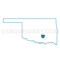
Voting District 67, Pontotoc County, Oklahoma
About
Outline

Summary
| Unique Area Identifier | 655036 |
| Name | Voting District 67 |
| County | Pontotoc County |
| State | Oklahoma |
| Area (square miles) | 38.09 |
| Land Area (square miles) | 37.97 |
| Water Area (square miles) | 0.13 |
| % of Land Area | 99.67 |
| % of Water Area | 0.33 |
| Latitude of the Internal Point | 34.76438800 |
| Longtitude of the Internal Point | -96.87168090 |
Maps


Graphs
Select a template below for downloading or customizing gragh for Voting District 67, Pontotoc County, Oklahoma


Neighbors
Neighoring Voting District (by Name) Neighboring Voting District on the Map
- Voting District 24, Garvin County, OK
- Voting District 58, Pontotoc County, OK
- Voting District 59, Pontotoc County, OK
- Voting District 62, Pontotoc County, OK
- Voting District 98, Pontotoc County, OK
Top 10 Neighboring County Subdivision (by Population) Neighboring County Subdivision on the Map
Top 10 Neighboring Elementary School District (by Population) Neighboring Elementary School District on the Map
Top 10 Neighboring Unified School District (by Population) Neighboring Unified School District on the Map
- Stratford Public Schools, OK (3,729)
- Latta Public Schools, OK (3,329)
- Vanoss Public Schools, OK (2,698)
- Roff Public Schools, OK (1,706)